


Understanding the Basics of Compass and Map
In the realm of navigation, the compass and map serve as essential tools, guiding adventurers through uncharted territories and familiar landscapes alike. A compass is a simple device that indicates direction by aligning itself with the Earth’s magnetic field. It consists of several key components, including the magnetic needle, housing, dial, and baseplate. The magnetic needle is crucial as it points toward the magnetic north, allowing users to determine their orientation relative to cardinal directions—north, south, east, and west. Understanding these parts is fundamental for anyone looking to master navigation.
Maps complement the information provided by compasses, offering a visual representation of geographical features and locations. They come in various forms, each designed for specific uses. Topographic maps, for instance, illustrate terrain relief through contour lines, revealing elevation changes and landforms that are invaluable for hikers and outdoor enthusiasts. These maps help users understand how to navigate through diverse landscapes, making it easier to plan routes and anticipate challenges.
Road maps, on the other hand, focus on transportation networks, showcasing highways, roadways, and critical landmarks. They are vital for drivers, providing information on routes, distances between locations, and important services. In addition, thematic maps can depict specific features such as climate zones, population density, or any other specific data overlays relevant to the user’s needs.
Utilizing both a compass and map enhances navigation skills, equipping individuals with the ability to traverse unfamiliar environments confidently. By understanding their basic components and various types, users can explore the outdoors or navigate urban settings more efficiently. Mastering these tools fosters a greater appreciation for the intricate relationship between humans and their surroundings.
How to Read a Map
Reading a map effectively requires understanding its various elements, including scales, symbols, and orientation. The first step is to familiarize yourself with the scale, which indicates the relationship between distances on the map and actual distances on the ground. For instance, a map scale of 1:50,000 means that one unit on the map equals 50,000 units in reality. This detail helps users accurately estimate distances and plan their routes accordingly.

- Made in the USA
- Updated
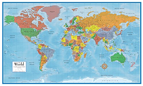
- Each Poster 18″ tall x 29″ wide
- FOLDED EDITION – portable 8×10 inch folded size
- WORLD MAP is printed on 24lb paper
- 3D SHADED RELIEF: 3D shaded visual terrain relief for land and oceans
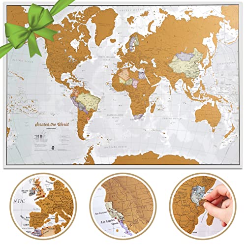
- Cartographic detail world map with us states: Our xl size allows for that extra map detail not seen on smaller maps. Scr…
- Extra large wall map: one of the largest scratch off map of the world poster’s you will find, measuring 23 (h) x 33 (w) …
- World scratch off map traveler gift: The most wished for wall map in the usa, this scratch off map of the world is a gre…
Next, pay attention to the symbols used on the map. Maps often use a key or legend to explain various icons that represent landmarks, roads, bodies of water, and other features. Recognizing these symbols is critical for analyzing the terrain and pinpointing locations efficiently. Additionally, understanding contour lines is essential for navigating topographical maps. These lines represent elevation and relief; closely spaced lines indicate steep terrain, while widely spaced lines suggest flatter areas. Contour intervals, which denote the difference in elevation between adjacent lines, can significantly influence your route planning.
To navigate effectively, it is crucial to orient the map with the help of a compass. Align the north on the map with the magnetic north indicated by the compass needle. This alignment allows you to interpret the map’s features in relation to your surroundings, making it easier to identify your current location and your desired destination. Furthermore, practicing triangulation can enhance your navigational skills. By taking bearings on recognizable landmarks and plotting them on the map, you can determine your position more accurately.
As you develop these skills, you will gain confidence in using maps for navigation. Understanding how to read a map provides a solid foundation for effective orienteering, making it a vital skill for outdoor enthusiasts and adventurers alike.
Using a Compass to Determine Direction
Using a compass is an essential skill for outdoor navigation. To effectively utilize a compass, it must be held correctly. Start by positioning the compass flat in your palm, ensuring the directional arrow or ‘nose’ points away from you, and the compass needle is allowed to move freely. Make sure that the base plate remains level for accurate readings. This correct posture will allow you to interpret navigational readings effectively.


Once the compass is properly held, you can proceed to take a bearing. To do this, rotate the compass housing until the orienting lines align with the magnetic needle, ensuring that the needle points north. The number indicated at the index line represents your bearing in degrees. It is critical to read the bearing from the front of the compass to ensure accuracy. For instance, turning your body until the north on the compass aligns with the magnetic needle will help you accurately identify the direction corresponding to your intended bearing.
Following a bearing in the field is a straightforward process. After determining your bearing, fix your eyes on a landmark in that direction. Walk towards this landmark while periodically rechecking your compass to maintain the correct trajectory. Strive to find a physical point you can recognize rather than fixating on an invisible line. Consistent alignment with your compass and regular recalibration of your route will help you stay on track and evaluate your progress.
Another important consideration is magnetic declination, which is the angle between magnetic north and true north. The declination varies depending on your geographic location, and adjusting for it is critical to ensure precision in navigation. You can reference current declination values on maps or online resources. By incorporating these adjustments into your bearings, you can enhance the accuracy of your navigation experience significantly.
Putting It All Together: Navigating with a Compass and Map
To effectively navigate using a compass and map, a structured approach is essential. Begin by familiarizing yourself with the map’s features, including its scale, symbols, and terrain contours. Understanding these elements will provide a solid foundation for your navigation journey. The next step involves orienting your map. By holding the map flat in front of you and aligning it with the north using your compass, you can accurately visualize the geographical context of your surroundings.
Once the map is oriented, you can identify your current location. This can typically be done by recognizing landmarks, trails, or other distinguishing geographic features. Mark this position as a reference point on the map. The next phase is to determine your destination. Once you have identified the desired endpoint, you will need to plot a course. To do this, use the compass to draw a straight line on the map from your current location to your destination. This line indicates the direction you will need to travel.
After establishing your course, you will need to take a bearing using your compass. Hold the compass flat in your palm, with the direction of travel arrow pointing toward your destination. Rotate the compass housing until the magnetic needle aligns with the orienting arrow. The reading at which the index line intersects the housing indicates your bearing angle, allowing you to set a precise direction for travel.
As you navigate, continuously check your compass to ensure you are heading in the right direction. Real-world scenarios, such as hiking through unfamiliar terrain or navigating at sea, exemplify the significance of these techniques. Always be mindful of safety tips, such as keeping your compass and map readily accessible and being cautious of obstacles while on the move. Utilizing both a compass and map in tandem enhances the navigation experience, providing greater confidence in reaching your destination.